OIL & GAS
The Oil and Gas industry is guided by an estimated 80% data that has a geospatial fundamental. OIL and GAS is the only industry that use GIS at every stage of the projects, starting with analysis and data building, right up to the consumer.
CartoSolution services increase your decision-making process throughout your operations workflow. Essential tasks, like planing access roads, devloping best routes for pipeline, complying with environmental Law's and a host of other key responsibilities become easier to visualize. Our focus is to reduce the project completion time and manage workflow to deliver the project on time with maintaining the product quality
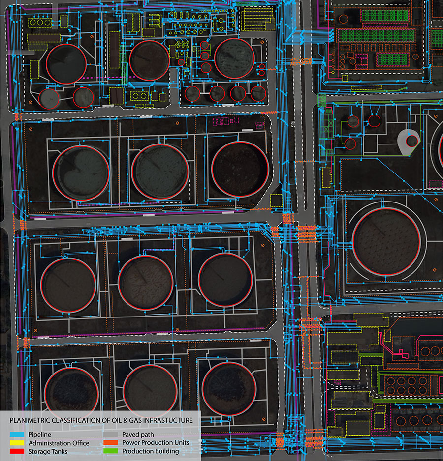
Planimetric maps are essential tool for planning and decision-making across life cycle of oil & gas operations, including exploration, infrastructure management, environmental planning and spatial analysis requirements. Cartosolution ensure fully customizable maps featurs that arrange and classified to display data for analysis and presintation.
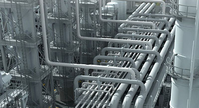
Our solutions are endorsed by seasoned domain expertise in consulting, analysis, design and deployment of enterprise solutions. Knowing that the Oil-GAS pipline goes through miles of pipline connecting the to end user, and we believe its very crucial to map and visualized the network on various platforms.
Mapping Details For Oil & Gas Infrastructure
- Emergency Mgmt. Facilities
- Manifolds
- Regulators
- Valves
- Flare Stacks
- Pipelines
- Pipeline Junctions
- Storage Tanks
- Terminals
- Wells
- Pumping Rigs
- Generators
- Power Stations
- Regulated Areas
- Fuel Stations
- Roads
- Administrative Buildings
- Maintenance Facilities
Asset Records management
- Records conversation
- Data integration
- Primary / Secondary connectivity
- Reactive change-out
Enterprise GIS
- Data Migration
- Data model / system design, development and integration
- Application development
Data management
- Network drafting
- GIS Data consolidation
- Legacy data conversion and migration
- Station modeling
- Geo Schematics configuration

Records Management
CartoSolution strengthen the client’s asset data records into a known GIS database. Key solution included transforming maintenance schedule forms in GIS environment, AS built drawings verification and entering in document management system, vectorizing, error correction, and validating electrical and civil primary / secondary connectivity in database, and maintaining underground cables in GIS, overhead legacy feeder layout conversion, and incorporating missing cross reference between core database for asset condition assessment (ACA) and non-ACA assets.
CartoSolution SERVICES FOR OIL & GAS INDUSTRIES:
LiDAR
LiDAR based DTM/DSM enhanced terrain data that make high accuracy using ground control point information. CartoSolution genrate high quality Digital Elevation and Digital Terrain Models (DEMs / DTMs) to support specialized tool requaired for oil & gas infrastructure, such as, orthorectification, and contours generation. DEMs and DTMs also can be use as base map for pipeline deployment, environmental studies, and construction.
3D Visualization & BIM integration
CartoSolution offers 3D Visualization and BIM services for a range of to oil & gas infra. We create virtual oil & gas infra such as pipelines, refineries, storage tanks, Administrative facilities, etc., to 5 levels of detail (LoD1-LoD5). The 3D models ready for seamless integration into any 3D software.